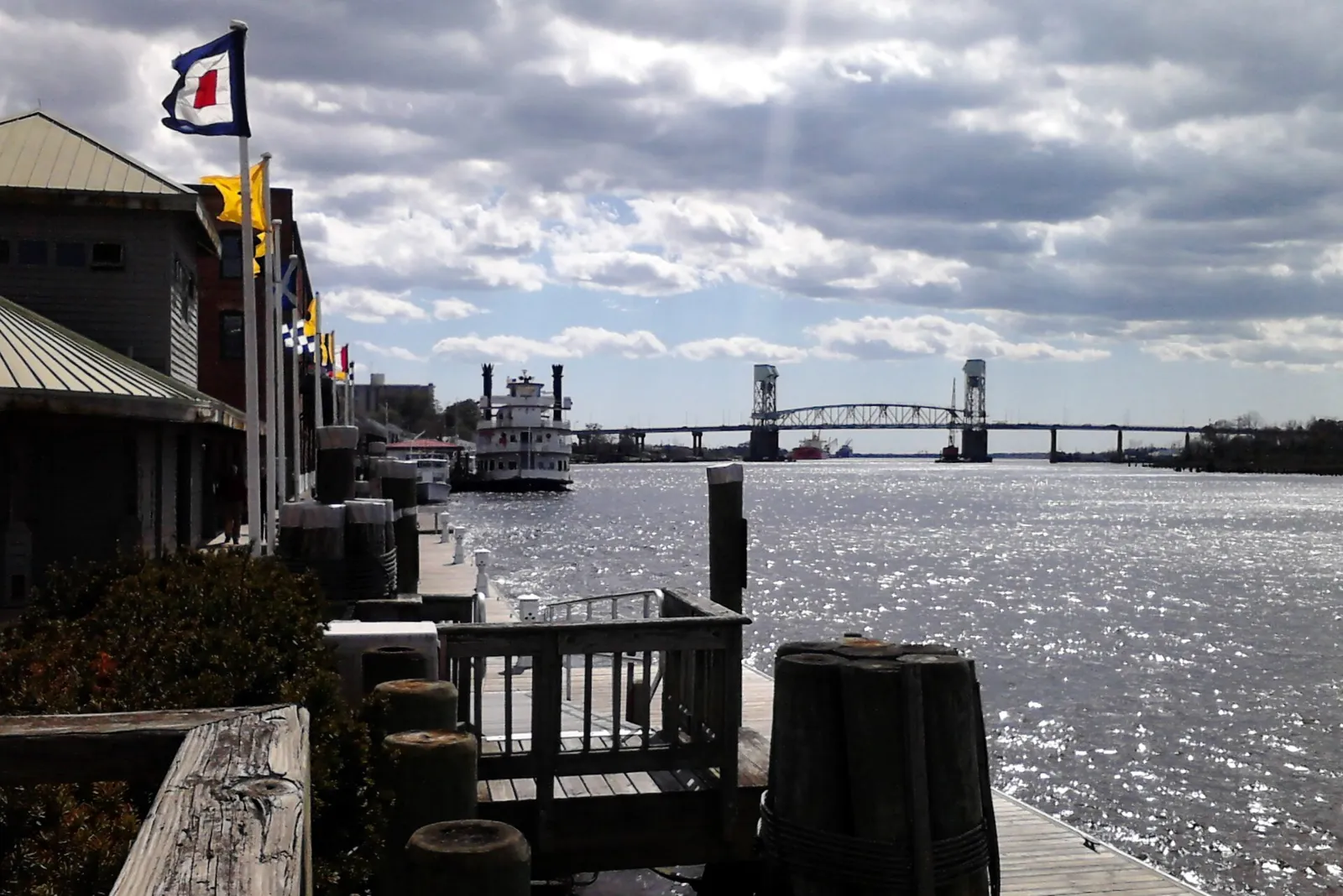
The Cape Fear River peaked at 5.65 feet at 12:24 p.m. Tuesday, just over flood stage at downtown Wilmington. Sunday's tide is forecast to reach 5.4 feet.
The Cape Fear River at downtown Wilmington reached 5.65 feet at 12:24 p.m. Tuesday, Oct. 13. Minor flooding begins at 5.5 feet, according to the National Weather Service. At that level, water starts to spread out of the storm drains onto Water Street just south of Market Street.
Updated Oct. 16: The gauge peaked at 5.65 feet Tuesday, slightly above the forecast 5.5 feet, according to the National Water Prediction Service record. The National Weather Service in Wilmington issued no coastal flood advisory for that tide; its last coastal flood statement of the spell was issued Sunday evening. Daily highs then fell to 5.27 feet Wednesday and 5.07 feet Thursday. The latest forecast, issued at 12:12 a.m. Friday, calls for 5.4 feet around 4 p.m. Sunday, Oct. 18. That is the gauge’s “action” level, short of flood stage.
The high tide came after a wet, stormy weekend. The river gauge peaked at 6.02 feet at 11 a.m. Sunday, its highest reading of the past week. Wilmington’s official weather station recorded 2.40 inches of rain from Saturday through 4 p.m. Sunday.
The river levels are from the gauge record and forecast published by the NOAA National Water Prediction Service. The forecast was issued at 1:20 a.m. Monday. The rain totals are from the National Weather Service in Wilmington’s daily climate reports for Wilmington International Airport.
What the river did over the weekend
High tides at the Wilmington gauge reached between 5.41 and 6.02 feet every day from Wednesday to Sunday. The National Weather Service in Wilmington issued coastal flood advisories for the lower Cape Fear River, including downtown, around the high tides on Friday, Saturday and Sunday.
Sunday’s advisory, issued at 8:07 a.m. and in effect until 1 p.m., said:
- parts of Battleship Road and USS North Carolina Road could see minor flooding up to half a foot deep
- a block of Water Street downtown could see flooding up to a quarter of a foot deep
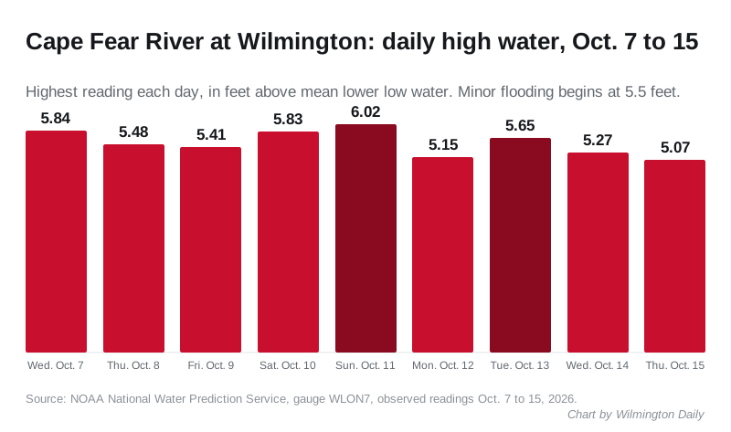
The daily highs at the gauge, according to the National Water Prediction Service, were:
| Day | Highest reading |
|---|---|
| Wednesday, Oct. 7 | 5.84 feet |
| Thursday, Oct. 8 | 5.48 feet |
| Friday, Oct. 9 | 5.41 feet |
| Saturday, Oct. 10 | 5.83 feet |
| Sunday, Oct. 11 | 6.02 feet |
| Monday, Oct. 12 | 5.15 feet |
| Tuesday, Oct. 13 | 5.65 feet |
| Wednesday, Oct. 14 | 5.27 feet |
| Thursday, Oct. 15 | 5.07 feet |
Readings are in feet above mean lower low water, the gauge’s own datum. Sunday’s and Tuesday’s highs were above the 5.5-foot flood stage. The table was updated Oct. 16 with observed readings in place of the forecasts first published.
Rain, wind and a tornado watch
Saturday brought 1.41 inches of rain at the airport, against a normal of 0.18 of an inch for the date. Sunday added 0.99 of an inch by 4 p.m. The highest gust was 38 mph, on Saturday. The figures are in the weather service’s climate reports for Saturday and Sunday.
The rain barely dented the dry year. Wilmington was still 7.91 inches below normal for 2026 as of 4 p.m. Sunday, according to the same report.
The weather service placed New Hanover County under Tornado Watch 680 from 9:58 a.m. Sunday. It was canceled for the Wilmington area at 2:28 p.m.
No tornado was confirmed in New Hanover County. The weather service’s preliminary storm reports for the weekend list none in the county.
A weak tornado did touch down near East Arcadia in Bladen County, about 28 miles northwest. A weather service survey team rated it EF0, with peak winds estimated at 75 mph. It traveled 1.68 miles at 12:54 p.m. Sunday and caused no injuries, according to the damage survey. The damage the team described was to trees: large pines and hardwoods snapped or uprooted, and limbs down.
The week ahead
The weather service in Wilmington expects a dry week that turns unusually warm. Its forecast discussion issued early Monday calls for:
- sunshine and a high near 82 degrees Monday, and 83 degrees Tuesday
- highs in the mid to upper 80s, with some spots near 90 degrees from Wednesday through Friday
- a dry cold front by the weekend, with lows in the low to mid 40s Saturday night
What it means for you
- Downtown on Sunday afternoon: the forecast 5.4 feet is just below flood stage, so Water Street south of Market Street may stay dry. If water does reach the street, do not drive through it.
- Battleship Road and USS North Carolina Road: these are the first roads to flood at the gauge’s 5.5-foot level, according to the weather service.
- Check before you go: the live river gauge updates through the day. The weather service posts any new advisory on its Wilmington forecast page.
- Road closures: state and city closures are on our road construction and closures page.
- Power: if an outage hits, our power outages page lists who to call.
Have your say