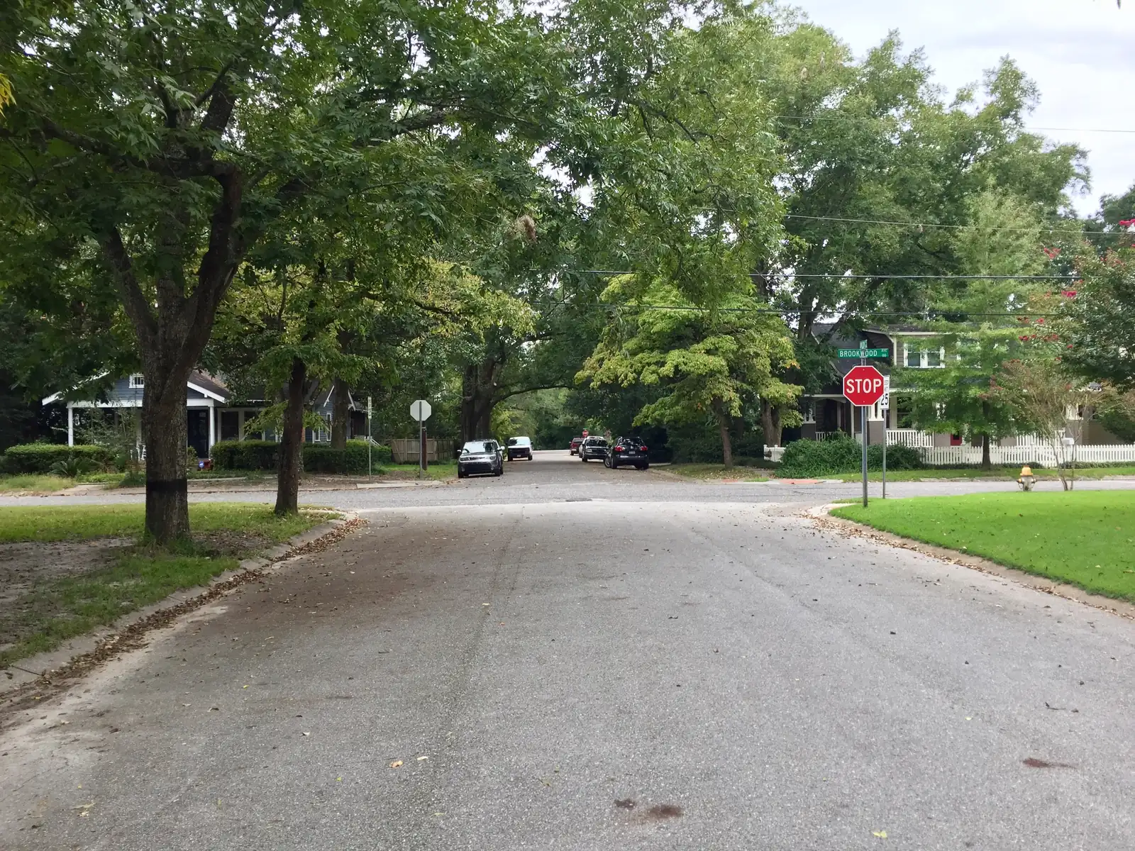
Ten Wilmington neighborhoods from the city's planning map, with ZIP codes, zoned high schools and Zillow home values for August 2026.
Last checked Oct. 11, 2026. Sources: the City of Wilmington’s neighborhood planning areas and city limits map layers, New Hanover County’s address points, © OpenStreetMap contributors, New Hanover County Schools’ School Locator, the N.C. Department of Public Instruction’s 2025-26 school test data, the Zillow Home Value Index (Zillow Research) and the Census Bureau’s QuickFacts.
Wilmington is a city of about 120,800 people, according to the Census Bureau’s 2020-2024 American Community Survey, on the peninsula between the Cape Fear River and the Intracoastal Waterway. The old city grid and downtown sit on the river in the west; newer suburbs spread east toward Wrightsville Beach and south toward Monkey Junction. College Road (U.S. 117/N.C. 132) is the main north-south road through the middle, and I-40 ends on the city’s north side, where it meets College Road at exit 420.
Three things to know before you pick an area:
- City limits are irregular. A Wilmington mailing address is often outside the city. In the six ZIP codes that cover the city, New Hanover County’s address records place about 77,200 residential addresses inside the city limits and about 45,300 in unincorporated county, which pays a county fire tax instead of the city tax. The county’s property search shows which taxing district a parcel is in.
- ZIP codes cross neighborhoods. Zillow’s figures below are for a whole ZIP code, which usually covers several areas and often land outside the city.
- School zones do not follow neighborhood or city lines. New Hanover County Schools zones by address. Inside the city, 55% of residential addresses are zoned for New Hanover High, 33% for John T. Hoggard High, 9% for Eugene Ashley High and 4% for Emsley A. Laney High. Check every address in the district’s School Locator.
What this means for you
- High schools: seven of the 10 areas in this guide are zoned for New Hanover High; Winter Park, Pine Valley and Masonboro are zoned for John T. Hoggard High.
- Home values: Zillow’s typical value in August 2026 ran from $330,529 in ZIP code 28401 to $513,664 in 28409 among these areas; the citywide figure was $419,038.
- Housing mix: Downtown and Mayfaire are mostly apartments and condos; Masonboro is almost all single-family homes.
The areas at a glance
| Area | ZIP code | Zoned high school | Typical home value in that ZIP, August 2026 | Guide |
|---|---|---|---|---|
| Downtown | 28401 | New Hanover High | $330,529 | Downtown |
| Northside | 28401 (96%) | New Hanover High | $330,529 | Northside |
| Sunset Park | 28401 | New Hanover High | $330,529 | Sunset Park |
| Forest Hills | 28403 | New Hanover High | $397,870 | Forest Hills |
| Winter Park | 28403 | John T. Hoggard High | $397,870 | Winter Park |
| Mayfaire | 28405 | New Hanover High | $375,126 | Mayfaire |
| Landfall | 28405 | New Hanover High | $375,126 | Landfall |
| Pine Valley | 28412 | John T. Hoggard High | $393,240 | Pine Valley |
| Masonboro | 28409 | John T. Hoggard High | $513,664 | Masonboro |
| Echo Farms | 28412 | New Hanover High | $393,240 | Echo Farms |
Home values are from the Zillow Home Value Index, a modeled typical value for the middle third of homes, not a sale price. Zoned schools are from every residential address in each area checked against the district’s zone map on Oct. 11, 2026. More in our home prices guide and schools guide.
Map
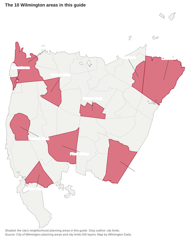
Map by Wilmington Daily from the City of Wilmington’s neighborhood planning area and city limits layers.
Downtown
The riverfront core, about 87 acres inside the Wilmington National Register Historic District, mostly apartments and condos. ZIP code 28401; zoned for New Hanover High. Read the Downtown guide.
Northside
About 1,160 acres north and east of downtown, including Carolina Heights, Brooklyn and Love Grove, with Northside Park and Pool. Read the Northside guide.
Sunset Park
A 748-acre south-side area with the Sunset Park Historic District, Greenfield Lake Park and Legion Sports Complex. Read the Sunset Park guide.
Forest Hills
Older homes between Market Street and Oleander Drive, including the Brookwood Historic District. ZIP code 28403. Read the Forest Hills guide.
Winter Park
A midtown area around MacMillan Avenue, zoned for Hoggard High and split between two elementary schools. Read the Winter Park guide.
Mayfaire
More than 1,200 homes, mostly apartments and condos, around the Mayfaire shopping district on Military Cutoff Road. Read the Mayfaire guide.
Landfall
The largest area here, about 2,458 acres on the east side by the Intracoastal Waterway, zoned for Wrightsville Beach Elementary. Read the Landfall guide.
Pine Valley
About 1,433 acres along South College Road with Halyburton Park and the Pine Valley Library. Read the Pine Valley guide.
Masonboro
Single-family homes on Masonboro Sound in ZIP code 28409, zoned for Masonboro Elementary and Hoggard High. Read the Masonboro guide.
Echo Farms
A 640-acre area west of Carolina Beach Road with Echo Farms Park, zoned for Alderman Elementary. Read the Echo Farms guide.
Comparing Wilmington with nearby towns
For taxes, schools, home values and town services in Wilmington, Leland and Carolina Beach side by side, see our comparison. For moving basics, see our moving here guide and property taxes guide.
How we built this
- Which areas: the City of Wilmington’s neighborhood planning areas map divides the city into more than 40 named areas and lists the neighborhoods inside many of them. We chose 10 spread across the city; most are also named as places, or contain places named, in OpenStreetMap. Each area page follows that planning area’s boundary. Other areas, such as College Acres, Lincoln Forest, Seagate, Echo East and River Lights, are not in this guide.
- Homes and ZIP codes: New Hanover County’s address points inside each boundary.
- Schools: every residential address in each area checked against the zone map behind New Hanover County Schools’ School Locator on Oct. 11, 2026, with a sample checked against the district’s 2026 zone maps, and 2025-26 test results from the N.C. Department of Public Instruction.
- Home values: the Zillow Home Value Index for August 2026, by ZIP code and for the city.
- Places, stores and road distances: © OpenStreetMap contributors.
Frequently asked questions
What are the neighborhoods in Wilmington, North Carolina?
The city’s planning map divides Wilmington into more than 40 neighborhood planning areas. This guide covers 10 of them: Downtown, the Northside, Sunset Park, Forest Hills, Winter Park, Mayfaire, Landfall, Pine Valley, Masonboro and Echo Farms.
Do Wilmington school zones follow neighborhood lines?
Not always. New Hanover County Schools zones by address. Winter Park and Pine Valley are each split between two elementary schools, and the city as a whole is split among four high school zones.
What is the typical home value in Wilmington, NC?
$419,038 in August 2026 for the city as a whole, according to the Zillow Home Value Index. By ZIP code it ranged from $330,529 in 28401 to $513,664 in 28409 among the areas in this guide.
Is every Wilmington mailing address inside the city limits?
No. In the six ZIP codes that cover the city, New Hanover County’s address records place about 45,300 residential addresses in unincorporated county, outside the city, against about 77,200 inside it.
Which high schools serve the city of Wilmington?
By New Hanover County’s address points and the district’s zone map, 55% of residential addresses inside the city are zoned for New Hanover High, 33% for John T. Hoggard High, 9% for Eugene Ashley High and 4% for Emsley A. Laney High.
Have your say